the ultimate floodplain marker
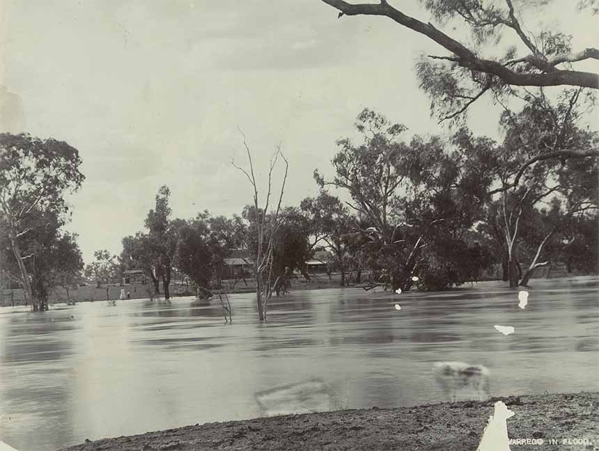
To begin to understand why blacksoil country is floodplain country you only need to look at some historical photos of the Warrego and Paroo Rivers in flood.
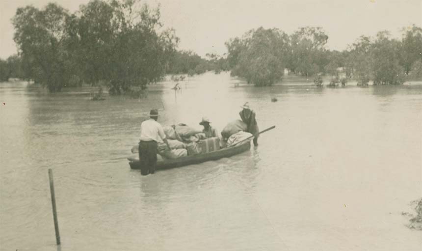
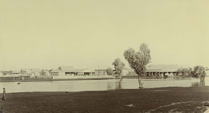
It's easy to imagine the muddy brown soup that flows out over the landscape when floodwaters swell up and out onto the floodplain.
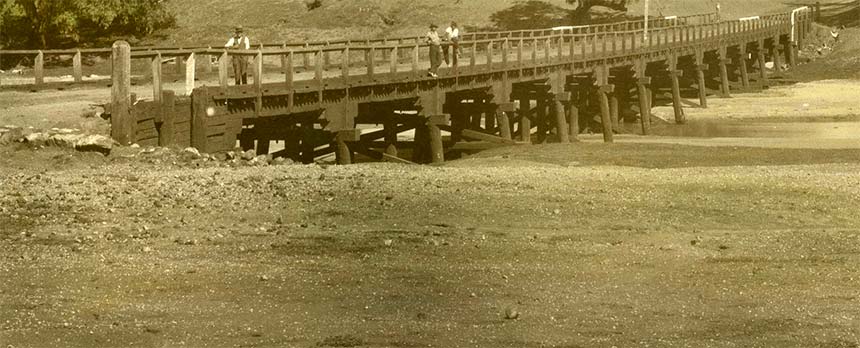
Here as their energy dissipates as the water spreads out and sits patiently, heavier particles like sand and gravels are quickly left behind either in or close by the main river channel. You can see these sediments in place on the river bed around the town's first bridge constructed in 1900 to the north of the town opposite the railway station.
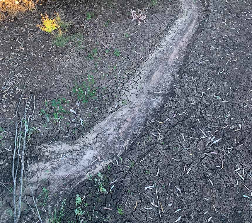
Very fine clay and silt particles however get carried along bound up like a thick cordial in suspension in the water.
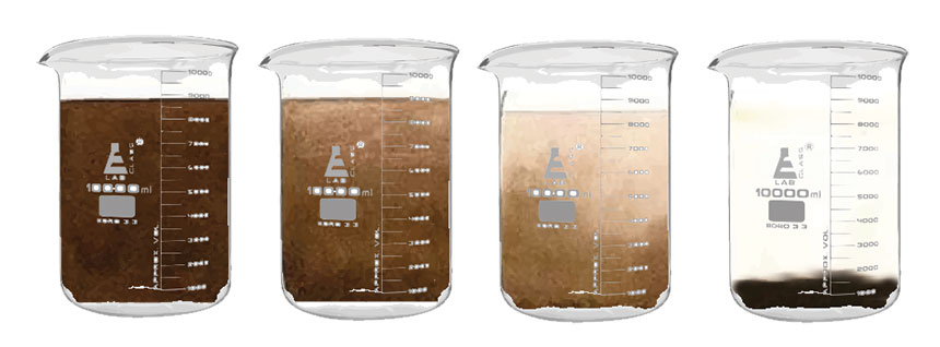
Over time these settle out and are finally left behind as a coating spread out across the floodplain when the water evaporates.
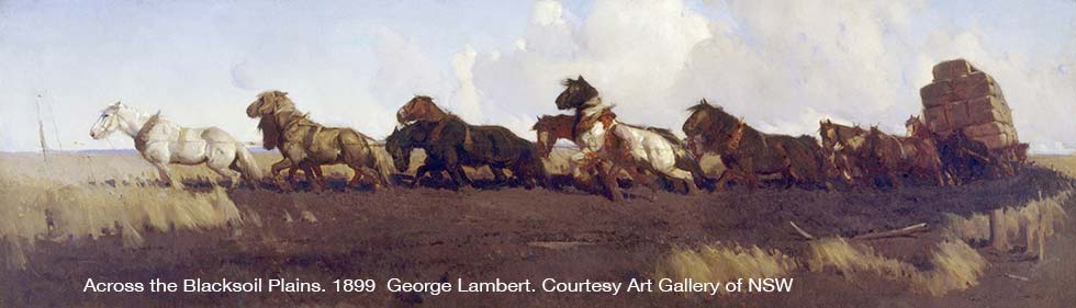
Blacksoil was both a blessing and a curse for the early pastoralists. The benefits came with the rich native grasslands that burst into life after rain. The troubles appeared when you tried to get a wagonload of wool across the quagmire that developed as the rain soaked into the soil. Sometimes there was nothing for it but to unharness the horses and return to try again once the soils had dried out.
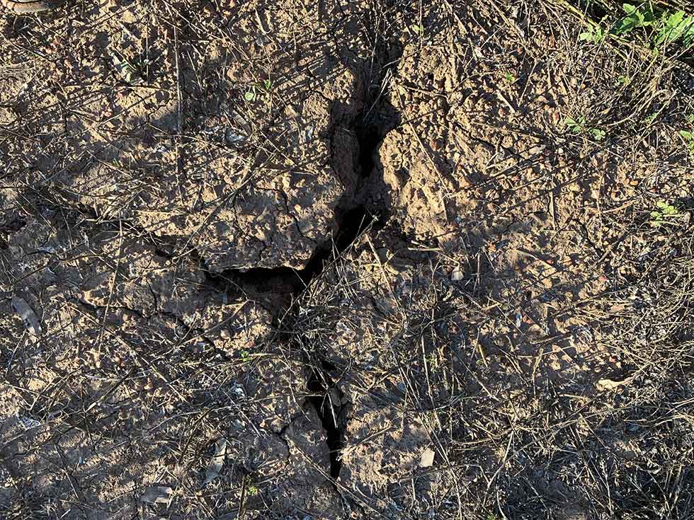
Perhaps the most powerful feature of black soil country is the fact that the earth is self mulching.
This means that when the soil dries and cracks open, dead leaves, twigs and seeds on the ground surface drop down the cracks.
The next fall of rain then mixes this organic matter with the surrounding clay and silt, as the soil swells out pushing upwards. Powered by nature’s own organic gardening system, blacksoils are capable of storing considerable moisture. Their fine texture and strong structure also make them resistant to erosion.
Underpinned by supersoils like this, it is no wonder that the Bushlands present such a wonderful spectacle following rain.
Blacksoil - gateway to the Warrego
The important role blacksoil plays in any broader understanding of the Warrego and Paroo Country is strikingly shown in a wonderful description put forward in a PhD thesis on the study and appraisal of the semi-arid lands of Eastern Australia by R. Heathcote in 1962.
He notes that:
The blacksoil country forms extensive alluvial grassy plains between watercourses fringed with coolabah and blackbox woodlands. In the dry months the soils crack and crumble to a fine powder, while in the summer downpours an impassable grey clay quagmire rapidly forms. Most of this country, in fact, is inundated by the highest floods. Land above the flood level is distinguished as red country, from the lighter colour and texture of the soils, which range from medium textured chocolate loams to coarse yellow and red sands.
The soft red country generally fringes the blacksoil plains, being slightly higher and carrying a thicker if lower stand of woodland, chiefly scrub timbers such as gidgee and brigalow, with less open grassy plains.
Where old dunes sand or “prior stream“ beds remain, low sandy rises dotted with pines or ironwood and spinifex break the monotony of the level plains.
In the west of the Warrego country is the hard red terrain and stony limestoneand sandstone ridges, where the soil is a thin veneer, red ochre in colour, often shot through with small lateritic pebbles and carrying a thick but low scrub woodland of mulga.
The contrast between these types of country is quite marked on the ground and has been a major factor in land appraisals over the past century.

3. Billabong
5. Woodland birds
